

Photos of algae in 1988 - too many nutrients
Pollution of Perdido Bay by the papermill
2018, 2019 and 2020 pictures of pollution
A short history of Perdido Bay
PB 2017 and 2018 Bacteria Report
Bacteriological Survey of Perdido watershed
Environmental Survey of Perdido Watershed
JOIN FRIENDS OF PERDIDO BAY AND GET A BIMONTHLY NEWSLETTER Click to download form.
Escambia County's soils data from the newly constructed boat ramp on Herron Bayou.
The stipulation in 2006 which ended the 2000 Class Action Lawsuit and allowed IP to pollute Perdido Bay for the next 15 years without fear of lawsuits. The 2000 Class Action was dismissed with prejudice
.Friends of Perdido Bay's latest data from Upper Perdido Bay which shows high bacterial levels in Perdido Bay.
A research study by UWF done in 2024in Perdido Bay only found oyster larvae south of Lillian Bridge.
A research study done in 1982 in the Journal WATER REARCH shows how oxygen is released from chlorine dioxide, the bleaching agent for the paper industry. The herbicide, chlorate, is also released. See below article on IP's effluent may be herbicidal.
A new report from Friends of Perdido Bay indicates IP's effluent may be herbicidal. Click for report. Also past reports have found chlorine dioxide (IP's bleaching agent) and chlorate in Elevenmile Creek. Click for first report and Click for second report. DEP claims that chlorine dioxide breaks down and is not harmful . But we found references about the harm of chlorate and chlorine dioxide. DEP and EPA must be wrong.
A study in May 2023 shows that the water coming out of International Paper at 11-Mile Creek causes deformed oyster larvae. Also free chlorine is present. This is illegal. Read the abbreviated report.
Upper Perdido Bay is more turbid than other bays. A summary of total suspended solids from various bays shows Upper Perdido Bay has nearly double the solids of other bays. Friends of Perdido Bay's recent data also shows the high total suspended solids and chlorine.

This recent muck at our beaches in January 2021 comes from International Paper dumping 8,000 to 16,000 ponds per day of dioxin-laden sludge. We have recently analyzed this sludge and it contains 9 to 11 ppt of dioxin.Click to see the dioxin report. And heavy metals report. Click for April 2021 dioxin report.
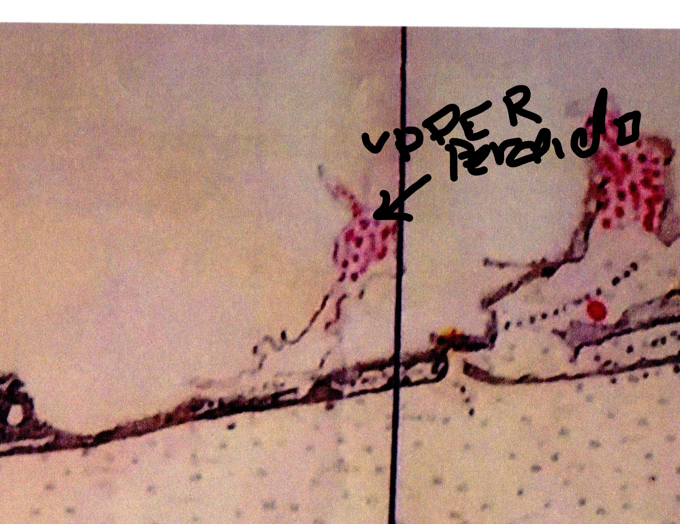
Diagram of oyster bars in Northern Gulf of Mexico 1883. Notice oysters in Upper Perdido Bay. There had been oysters in Upper Perdido Bay until the paper mill started manufacturing. See UWF presentation at https://fb.watch/ePTf3U3qi8/ This is a new address.
.In 2003, the Levin Law Firm from Pensacola commissioned a study to be done by Dr. Ken Heck. Read the entire study. It tells how unpolluted Perdido Bay was before the paper mill began dumping.
International Paper releases huge amounts of toxic chemicals (COD) every day. IP's average Chemical Oxygen Demand(COD) in December 2017 was 40,349 pounds per day. Click to see chart of 2017 and 2018 IP releases. Also a graph Click to see Chemical Oxygen Demand in Pounds per day from 2013 to present
IP has submitted a new Corrective Action Plan to the Florida DEP. The "plan" will give them more time to kill life in Perdido Bay. They are proposing going into salt water in Upper Perdido Bay. Click for report
The Florida DEP has adopted nutrient limits for Perdido Bay. They are very high - 1.27 mg/l for Total Nitrogen in the Upper Bay and Total Phosphorus of 0.102 mg/l. The limits do not match the supporting documents. WHY? Click for the Supporting document
Friends of Perdido Bay commissioned an ecological study for Upper Perdido Bay. The study demonstrates how little life is present. Click for report
A new threat to the water quality in Perdido Bay has arisen. Bayou Marcus waste water treatment plant is increasing its discharge to wetlands which drain into Perdido Bay. Studies have shown that there will be a net increase in nutrients entering Perdido Bay from this sewage. Click to read the 2018 Draft permit for Bayou Marcus
PCBs are going up in Tee and Wicker Lakes Click for PCB and Dioxins. Heavy metals and mercury are increasing in Wicker and Tee Lakes. Click for Metals
Perdido Bay makes up the border between Florida and Alabama. Perdido Bay encompasses an area of about 50 square miles with the state line running approximately down the centerline of the bay. It has an elongated shape which lies along a northeast-southwest axis. Perdido Bay is relatively shallow in the Upper part near the mouth of the Perdido River but gets deeper toward the Gulf of Mexico
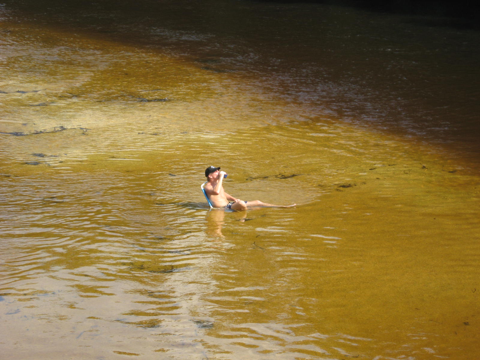
The Perdido River provides most of the fresh water (>70%) for Perdido Bay. The Perdido River is a Florida outstanding water and the water quality in the upper Perdido River is considered to be very good. On a Sunday afternoon, sitting in the river on a lawn chair is refreshing. Click for visual image. The Perdido Bay watershed covers 1205 square miles which is considered large for a small bay. The Upper part of Perdido Bay and to some extent lower Perdido Bay are polluted with wastes from a paper mill, now owned by International Paper Company. See the photo pages and pollution page on the left.
A member who passed away recently remembered how bountiful and beautiful Perdido Bay was.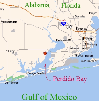
Click for her words